


Map Questions
Updated
On this page
A Map question shows a map, and the respondent marks one or more places on it, for example "Where do you usually buy coffee?" or "Which cities have you visited this year?". Each mark gets a place name, and you get the names and coordinates in the report and the export.
Paid feature. Available on the Standard plan and higher. Compare plans
Adding a Map question
- In Builder, click + and choose Map in the Additional section. More about adding questions: Question Types.
- Click the map and move or zoom it to the area respondents should see first ("Move the map to set the view respondents will see"). To go back to the default view, click Reset view.
- Click the gear icon (Settings) and set up the question.
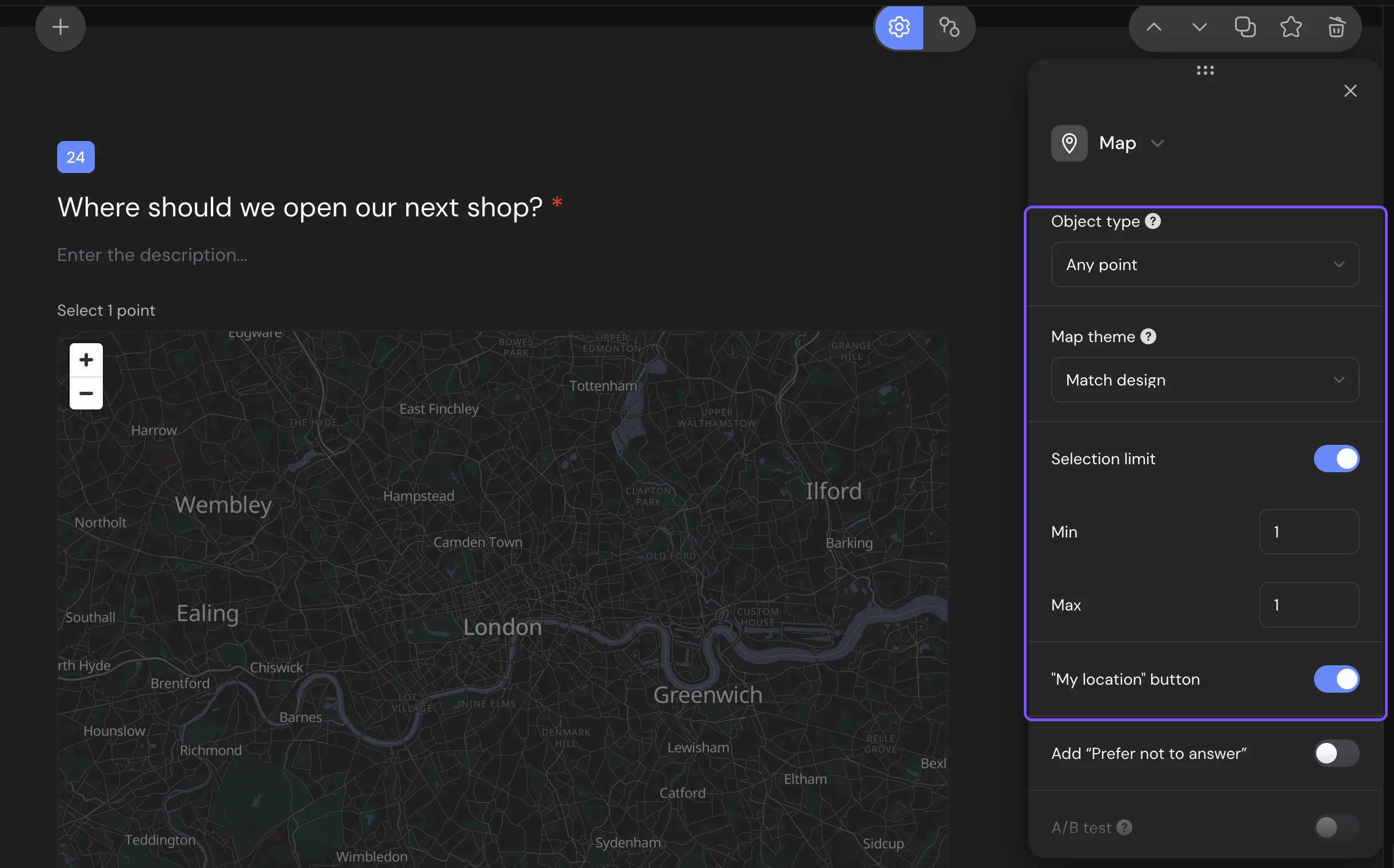
Settings
| Setting | What it does |
|---|---|
| Object type | What a mark names. Any point: the clicked spot and a nearby name, a street or a place. City or town: only the city; the same city can't be selected twice. Street: the clicked spot and its address, without place names. |
| Map theme | The map background respondents see. Match design picks light or dark by the survey background color. Light and Dark fix it. |
| Selection limit | Turns on Min and Max: how many marks the respondent must and can put. |
| "My location" button | Shows a button that puts a mark at the respondent's location. On by default. |
Without Selection limit, the respondent puts one mark. With Selection limit on, the Required response switch is locked: the question is required when Min is above 0. The settings that every question has are described in Question Settings.
What respondents see
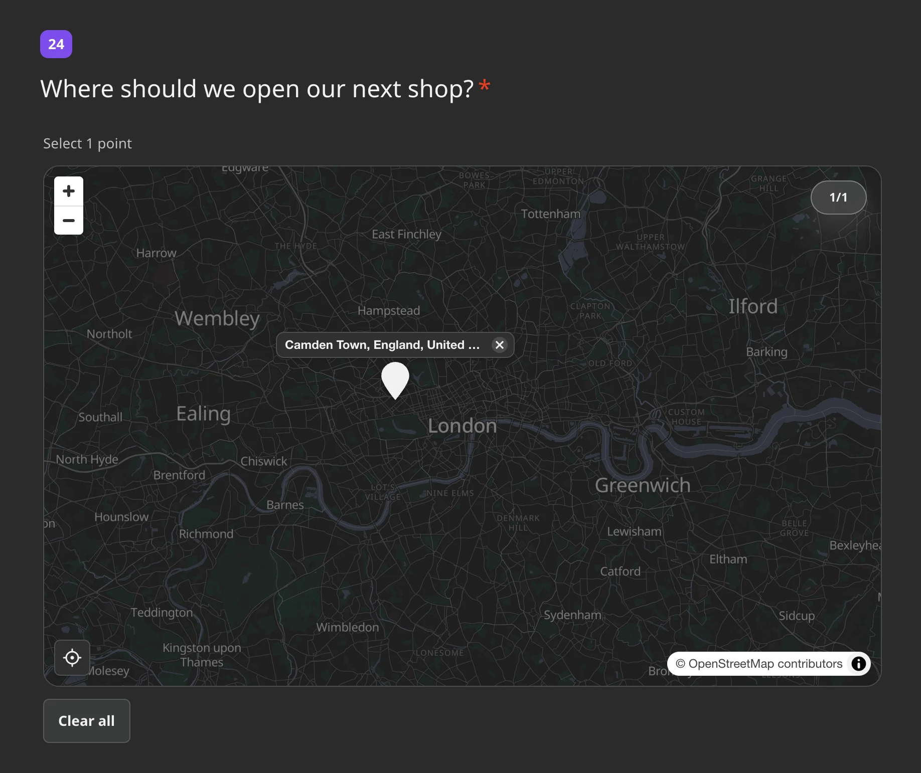
The respondent clicks or taps the map to put a mark, and its name appears next to it. With one mark allowed, a new click moves the mark. With several, a hint shows how many to put, for example "Select up to 3 points". Clicking a mark removes it, and Clear all removes all marks.
The location button asks the browser for access. If access is denied, the respondent sees "Location access denied" and can mark the place by hand. On a phone, the map moves with two fingers, so the page still scrolls with one.
Responses and report
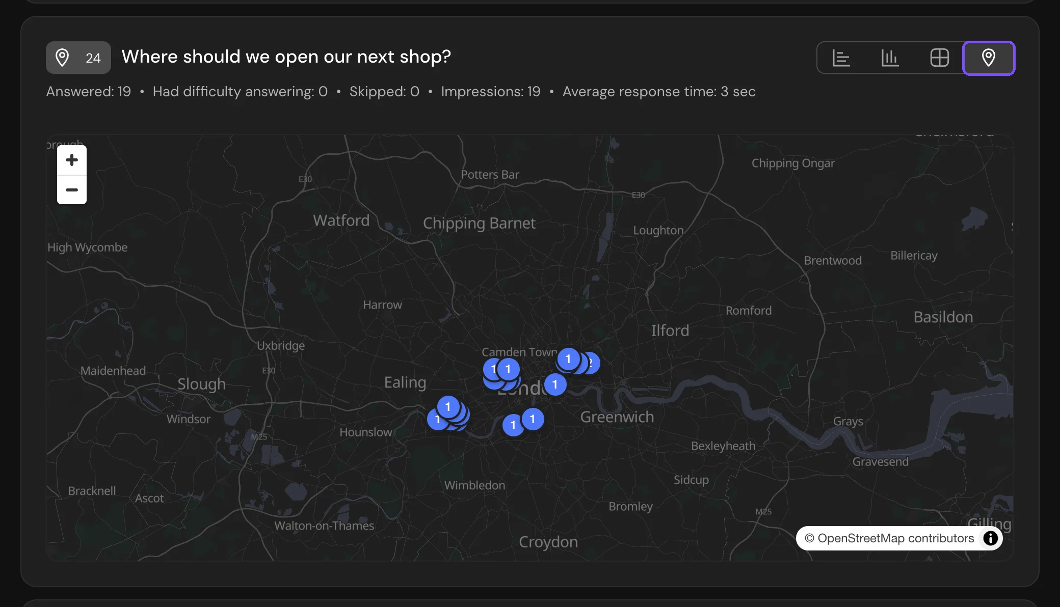
In Results → Reports, the Map card groups the marks by place name. Switch between List, Bars, Table and Map. The share of each place is counted from the respondents who put marks. One respondent can mark several places, so the shares can add up to more than 100%. The Map view shows the marks with their counts.
In a CSV or XLSX file, each mark takes three columns: the place name, then "latitude" and "longitude" as numbers. The number of mark columns equals Max (or 1 without a limit), so the columns are the same for every response. More about export: Viewing and Downloading Survey Responses.
Logic
Logic checks the number of marks: Less than, Less than or equal to, More than, More than or equal to, Equals, Does not equal and Is answered. Map answers can't get scores. See Logic Jumps.
Limits
- The Map question is available on the Standard plan and higher.
- The export has columns for up to 30 marks per question. If Max is higher, the extra marks don't get into the file.
- Map can't be added to a micro survey.